LDN: Land Degradation Neutrality Platform for EMA
Flotech engineered an environmental intelligence platform that helps the Environmental Management Agency monitor land degradation, coordinate field interventions, and align reporting with UNCCD frameworks — from soil sampling to drylands dashboards.
The Challenge
Land degradation affects agricultural productivity, water security, and climate resilience at national scale. EMA needed a unified digital system to replace fragmented spreadsheets and ad-hoc reports — one that could ingest field data, visualise degradation trends spatially, and support Land Degradation Neutrality (LDN) commitments under the UN Convention to Combat Desertification (UNCCD).
Key requirements included multi-module access for operations teams, a spatial view of interventions, soil sample tracking, drylands-specific workflows, and a field photo gallery for audit evidence.
Flotech's Solution
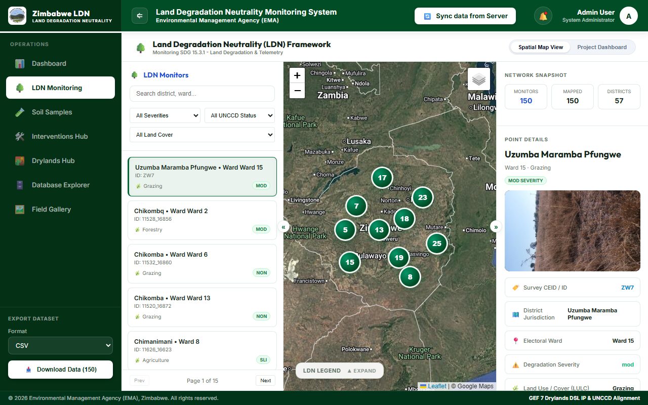
We delivered the LDN Monitoring System — a Web GIS platform with dedicated hubs for LDN monitoring, soil samples, interventions, drylands, database exploration, and a field gallery. The architecture separates operational dashboards from geospatial analysis layers, allowing administrators and field coordinators to work from the same authoritative dataset.
Platform Modules
- LDN Monitoring Dashboard — national overview of degradation indicators and framework progress
- Soil Samples Hub — chain-of-custody tracking from collection points to laboratory results
- Interventions Hub — spatial registry of remediation projects with status and impact notes
- Drylands Hub — tailored views for arid and semi-arid land management programmes
- Field Gallery — geotagged imagery for verification and stakeholder reporting
Technology Stack
Outcomes
EMA teams now operate from a single environmental intelligence platform rather than disconnected tools. Spatial context helps prioritise interventions, while structured modules support GEF-aligned drylands programming and UNCCD reporting cycles. The system is live at land-degradation-neutrality.com.
Why It Matters for Environmental GIS
National environmental agencies increasingly require production-grade geospatial systems — not static maps. The LDN platform demonstrates how integrated Web GIS, operational dashboards, and field evidence pipelines can support policy-grade monitoring at scale.
Need a Web GIS platform for your agency?
Flotech builds SDI portals, environmental dashboards, and field-to-office GIS pipelines for clients worldwide.
Request a Consultation View Live Platform